
Info
This page may be partially machine translated.
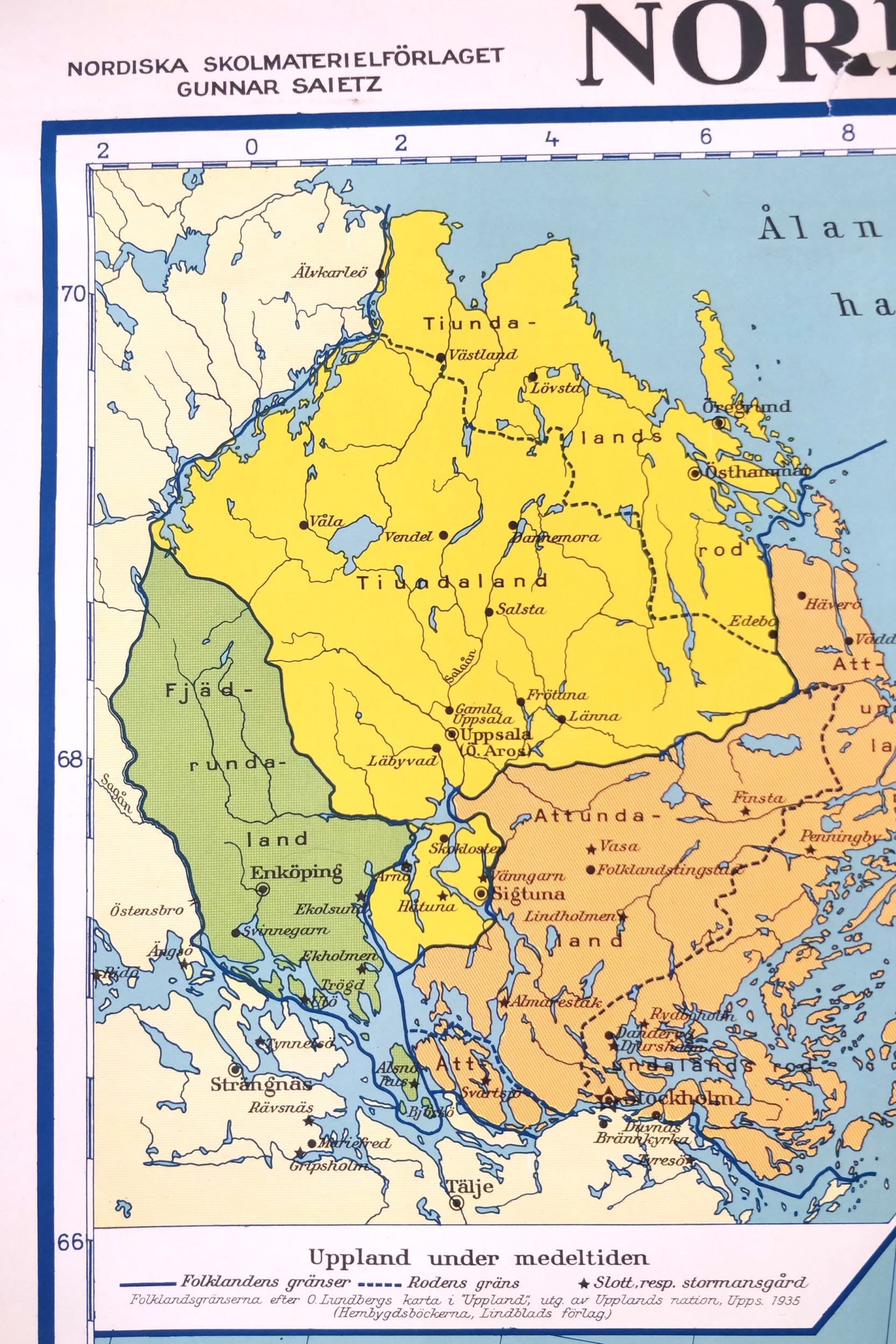
Fjärdhundraland - ancient times, the Viking age and Middle Ages
Up to the end of the 13th century, what is today called Uppland was divided into folklands. Fjärdhundraland (sometimes spelled Fjädrundaland) was the western folkland, with Tiundaland to the northeast and Attundaland to the southeast. Fjärdhundraland stretched from Färnebofjärden in the north to Birka in the south, i.e. roughly the present-day municipalities of Heby and Enköping. No one knows exactly how the borders have been drawn throughout history. Ancient and Viking people were dependent on trade, and on alliances. Family ties and friendships were vital. To maintain these ties, they needed to be able to visit each other - then, as now, they needed good communications. The whole nation was built around the important roads. So how did they get around?Örsundaån - Viking Age E18
The water was the highway and the river Örsundaån made life and trade possible in Viking Age Fjärdhundraland. The boat was the fast means of communication, which meant that both iron ore and agricultural goods could be transported south and east, to the "big cities" Old Uppsala and Birka. Think about it when you visit Örsundsbro today! Here, goods were shipped out to the trading places in Gamla Uppsala, Birka and eventually to Stockholm.Dry-shod to Enköping
But roads were also needed on foot and on horseback. A safe way to get around without a map and compass was to follow the sandy ridges - always well-drained so they stayed dry all year round. The risk of getting lost was minimal; just follow the ridge. Enköpingsåsen is one of the mighty ridges left behind by the inland ice, which joins the Örsundaån river south of Heby. When Örsundaån turns to the east, the ridge shows the way straight south to Lake Mälaren and the trading post that came to be known as Enköping. Thanks to Örsundaån and Enköpingsåsen, people of the Viking Age were able to trade, travel and live in the Fjärdhundraland homeland.
